Parts of London and the South have flooded after torrential rain and the Met Office has issued an amber storm warning.
Areas including Hackney Wick, Newham and Barking were affected by the downpours, with videos showing cars driving through deep water and people walking nearly knee-deep at times.
Another video shows Pudding Mill Lane DLR station in Stratford underwater after heavy rainfall on Sunday.
Thunderstorms bringing lightning and the threat of flooding to the South are set to continue until Monday, forecasters have warned.
The Met Office issued an amber warning for storms covering London and surrounding counties where homes and businesses are at risk of flooding, which was in place until 7pm on Sunday.
The torrential downpours come after a heatwave earlier this week brought days of record-breaking temperatures.
A yellow warning for storms which could cause travel and power disruption also covers a wider area of the South from Norwich to Plymouth, and lasts until midnight.
Image:
Heavy rain could cause hazardous conditions for drivers
Residents in Woodford were forced to use buckets, brooms and wooden boards to create flood defences and scoop the water from their homes.
One local, Mariya Peeva said: “My son went to buy some food from the local shop – by the time he came back the whole street and the pavement were already flooded and the water was coming into our front door.”
Buses have also been left stranded on waterlogged roads in Battersea.
Mayor of London Sadiq Khan advised people to “avoid walking or driving through floodwater” and to call 999 in an emergency.
Local emergency services, @LondonFire, and @MetPoliceUK are responding to significant flooding across London. If you’re travelling, check your route as multiple @TfL bus, tube and rail services are affected. Avoid walking or driving through flood water. In an emergency, call 999.
— Mayor of London (@MayorofLondon) July 25, 2021
He said: “Local emergency services, @LondonFire, and @MetPoliceUK are responding to significant flooding across London.
“If you’re travelling, check your route as multiple @TfL bus, tube and rail services are affected.
“Avoid walking or driving through flood water. In an emergency, call 999.”
Met Office meteorologist Steven Keates said parts of the South between south Suffolk and the Isle of Wight could be deluged by 100mm of rain in just a few hours on Sunday evening.
“There’s torrential thunderstorms around yet again,” he said.
“Into the evening, from Norfolk to Bournemouth we are going to see some pretty lively showers.
“Torrential downpours, thunder and lightning and potentially some hailstones are settling in the South.”
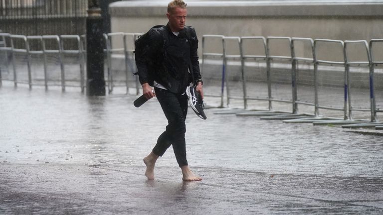
Image:
One gentleman thought it would be a good idea to take his shoes off as large puddles formed in central London
Mr Keates said the storms are being caused by a “convergence” of air currents, due to warmth in the Earth’s surface from the recent heatwave rising into cooler air in the atmosphere.
It comes after lightning set fire to houses in Andover, Hampshire, on Saturday morning, forcing residents to leave.
Neighbours heard an “enormous bang” as the strike set two homes ablaze on Mercia Avenue, and a 70-year-old woman was assessed by paramedics.
Kingston Police, who oversee a borough in the amber zone for storms, warned motorists to “drive carefully” and remember they are “not driving a submarine”.
The force said in a tweet: “Please remember to drive carefully.
“Also remember that you’re not driving a submarine.
“Do not enter what could possibly be deep water.
“Watch your speed and distance as stopping distances will be greater.”
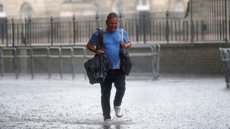
Image:
Heavy rain is falling on central London as the Met Office has issued amber warnings for the South
The rain brought an end to the heatwave earlier this week, potentially disappointing anyone who hoped for a dry, sunny trip to the coast.
The rest of the country was forecast to experience a cloudy, more settled end to the week while sunshine is expected in Scotland.
Temperatures are set to rise in most places again on Monday as the storms clear, with the mercury predicted to reach 26C in London, 25C in Edinburgh, 24C in Cardiff, and 22C in Belfast.
The Met Office has predicted early cloud in some northern and eastern parts which will move up to Scotland, and sunny spells and scattered showers in most places throughout the day.
https://news.sky.com/story/uk-weather-dlr-station-underwater-and-flooding-across-london-as-thunderstorms-to-continue-into-monday-12364014

